

As the county remains soaked from Tuesday rain water, snow flurries fell Wednesday and according to weather.com, it may not be the last of the snow.
“We have closed some roads due to high water over the past couple days,” Fayette County Engineer Steve Luebbe said. “We will do the best we can to have signs up as they need to be, or even close roads as they have to be, but we can’t be everywhere all of the time. Everyone has to be vigilant for their safety.”
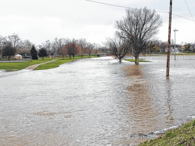
With different areas of the county still under water, residents should prepare for more bad weather over the next week. After a mild to cool Thursday with partly cloudy skies, Friday could see more rain, snow and low temperatures.
“You always have to be careful out there,” Luebbe said. “Water comes up in the middle of the night and you always need to pay attention and be 100 percent aware of what’s going on around you. That includes the road condition.”
According to weather.com, the high temperature for Friday is 49 degrees with a low of 27. Cloudy skies with occasional showers will dominate the afternoon before rain and snow turn into all snow late Friday night. The current chance of precipitation is 70 percent and the county could see snow accumulation around one to three inches.
“Bad weather and a forecast for bad weather are typically two different things,” Luebbe said. “We are ready. If we get some bad weather the trucks will be ready and the guys will be ready to go. But we are going to wait and see what the situation calls for.”
Next to no precipitation is expected over the weekend, but beginning on Saturday and ending Sunday, temperatures in the night time are forecasted to remain below freezing. The low temperature for Saturday is 20 degrees and the low for Sunday is 30 degrees with highs around 40 degrees both days.
Come Monday the skies will be cloudy with rain and snow showers changing early to mainly rain showers in the afternoon. The high temperature is expected to stay around 47 degrees. About one inch of snow is expected. During the night, considerable cloudiness will join temperatures around 34 degrees for a cool evening. Winds will blow 10 to 15 miles per hour.
After Monday, weather.com is forecasting a considerable amount more rain throughout the middle of April, with a current forecast expecting rain for seven straight days beginning on April 12.